State of Franklin Linear Trail- South
And so the adventure begins! As an organization that is making biking, walking, and busing better in the Appalachian Highlands, RIDE JC hopes to help you get to know the area’s multi-modal transportation options, and anything else related to the subject, with a blog.
We begin with a post about the southern section of the State of Franklin Linear Trail, a multi-use trail that was born in the early 1990s and has slowly been added to since.
But first, a quick overview: The trail, in its entirety, has three unconnected sections.
A south section, starting downtown in front of the new Johnson City Visitor Center at the southwest corner of W State of Franklin Rd and Buffalo St. This section ends at the State of Franklin entrance of the VA Mountain Home campus (at Mountain Home Dr/Jack Vest Dr).
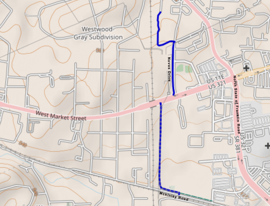
A middle section that fills a transportation gap in a part of town that hasn’t seen much development. It starts at the intersection of Mckinley Rd and Professional Park Dr, and ends at Novus Drive.
And finally, a north section, which is the oldest part of the trail, going from Sunset Dr all the way to the intersection of Greenline Rd and People St.
We’ll be posting separate blog entries for each trail section, including information on planned growth and any changes that we’d like to see.
This tour will begin on the south end of Johnson City, starting at the new visitors center downtown. The area features local restaurants, breweries, coffee shops, two parks, and plenty of shopping. It's a great place to visit before or after your ride.
The southern part of the trail starts at the corner of Buffalo St and State of Franklin Rd and meets at the “Downtown Spur” with lots of signage for the “Tweetsie Trail Spur”. Finding your way using the city’s Trails Map might be confusing, but if you make it to the visitor center, it’s obvious which part of the trail goes away from downtown.
For those who enjoy online maps to track local paths, OpenStreetMaps is recommended. Ride JC has volunteers who update OpenStreetMaps by trying the paths themselves and mapping them.
The visitor center is in an old train depot and has a nice feel to it. It also has a convenient bike rack that can hold two bikes but might fit a third if you're friends with them. Bike parking is a big deal for Ride JC, we will discuss that more with a special blog post!
The trail begins with some newly poured concrete as part of the W. Walnut St Development. There are many changes anticipated in this area, as can be seen from the link. We are most excited about the addition of parks and buffers between the State of Franklin and the Linear Trail. The images below show how having some foliage along the trail can change the overall mood and help reduce noise.
As we ride our bikes along a flat trail that resembles an oversized sidewalk, we notice a mix of businesses to our left and a four-lane road to our right. In the distance, we can see a residential neighborhood on a hillside. This part of the trail has a new, clean feel to it, yet there's still a lot of construction going on. So be careful when crossing these particular areas being renovated. Keep in mind that this section of the trail is constantly changing, and we expect to see work in progress for the foreseeable future.
A multi-use path is being built at the intersection of the State of Franklin and the new Cherokee St extension. This path will connect to the W. Walnut Street development and improve mobility in this mixed-use area of the city. The area is also being considered for a possible renovation. Recently, Johnson City was awarded a grant of $3,386,655 from the Tennessee Department of Environment and Conservation (TDEC). According to the TDEC's website:
“The City of Johnson City will use ARP funds on the West Walnut Basin project. This will improve hydrology and reduce flood activity during extreme weather events through the removal of warehouses on the site and the restoration of pervious land through the creation of a pond with increased natural vegetation, and the installation of a high-density polyethylene pipe.”
It will be exciting to see how this project improves the experience of riding or walking along this part of the trail.
We have reached the most challenging part of the southern section of the trail, the intersection of University Parkway and West State of Franklin. The constant traffic, noise, and slip lanes at the curb cuts for this crosswalk make this part of the trail stressful. Additionally, the distance between the crosswalk signal and the start of the crosswalk is wide, which can be problematic for people who travel at a slower pace or rely on assistance for their mobility. To access the greenway section of the trail, you will need to cross two busy roads. Firstly, University Parkway, followed by West State of Franklin Road heading north.
One thing that seems a bit odd is the benches facing the artwork display. While it is a great idea, it feels a little thrown together, especially on a sunny day. The lack of trees, native grasses, and pollinators on this street corner makes it feel barren. However, as the W. Walnut St corridor develops further, we hope to see more improvements in this area. Hopefully, we will see more greenery and natural elements incorporated into the gallery.
After crossing the chaos of two four-lane roads intersecting, we find ourselves on a calm off-street path. If we want to head to the north section of the STOF Linear trail, we need to take a left turn. If we take a right, there is a beautiful path that leads to some apartments and back to downtown, but we can explore that trail another day.
Taking a left, we will pass behind a strip mall that has a few restaurants and retail stores. However, to reach these amenities, we will have to leave the trail and take a shortcut onto Millennium Place. Once there, we will need to navigate through the parking lot of the strip mall. The path could be improved significantly by including direct routes to stores and office complexes.
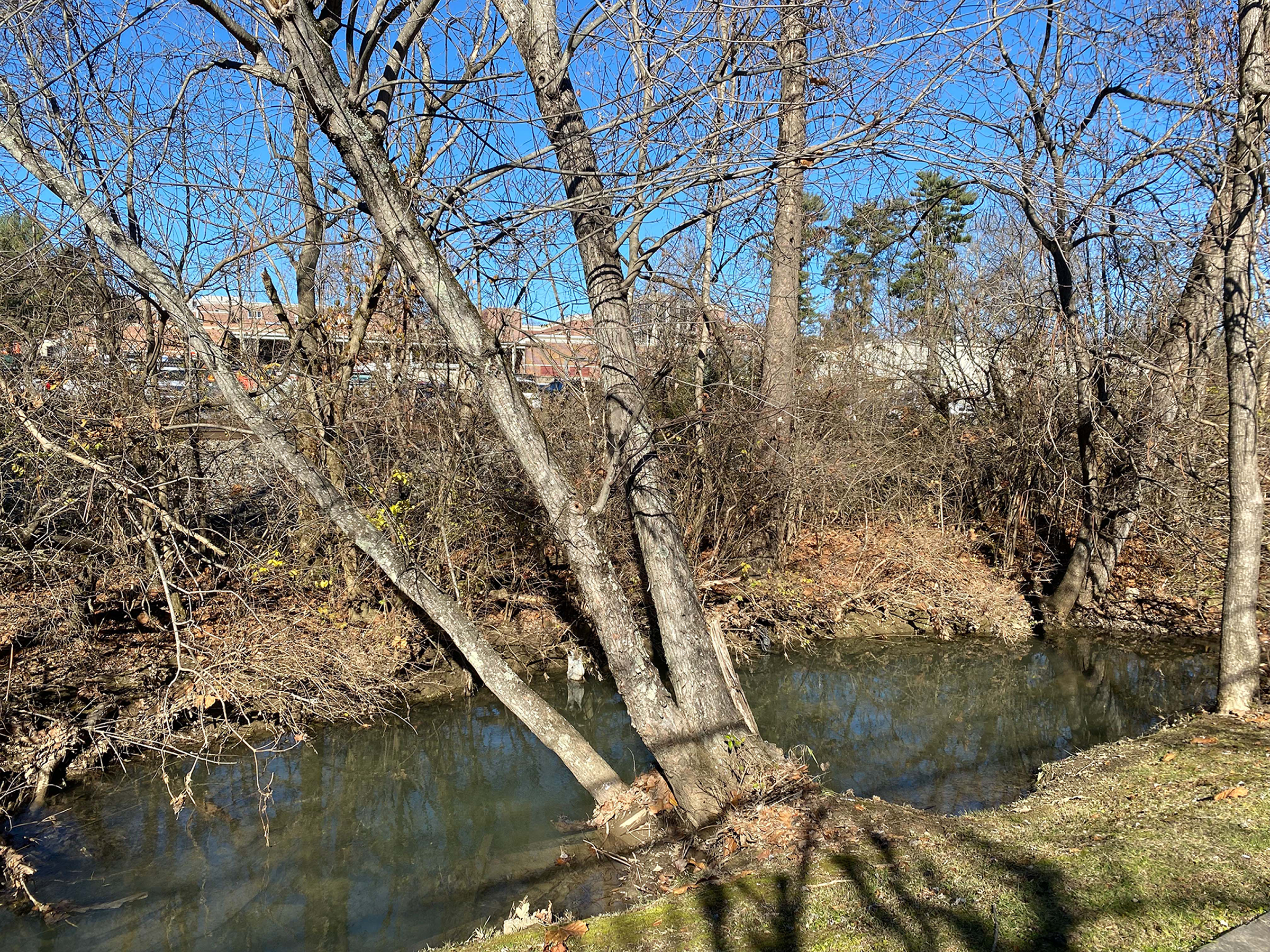
Between our last road-crossing and the end of this trail section, we spend some time next to Brush Creek, a bit of hidden nature amid the bustle of a growing city.
Brush Creek helped bring the steam engine to Johnson City before it even had its present name. It’s been here long before this area was settled. Still flowing by, doing its thing, only to be awakened when its 16-mile watershed has overpowered it. On a day like today though, it seems like it’s inviting us to take a break and slow down.
.
As we come to the end of the southern section of the State of Franklin Linear Trail, we are left with the same amount of information as we had when we started. If you do your research before you leave the house, you will know it's the end of the trail. However, if you're a visitor and just happen across this multi-use path, you might be left asking yourself a couple of questions. Where does this trail lead? How far is it to downtown? Where can I find the nearest amenities? With proper signage and some well-placed maps, I think that people who are trying alternative transportation for the first time could easily manage this trail.
On a positive note, the path does end at the entrance of the VA Mountain Home campus. Which sports a nice pond and is frequented by joggers and people just out for a stroll.
At the end of the day, I think this trail attempted to accomplish the goals that it set out to do at its inception. In 2009 a Bikeway-Greenway Plan was created to supersede the 1994 bicycle plan for Johnson City. In this plan the city set out seven main goals to accomplish when building these greenways:
Goal 1: Providing safe, convenient bicycle facilities. The city has indeed put in some safety measures to help cyclists and pedestrians get around on these trails. Especially the section of the path running behind the businesses away from the main roads and the crosswalks with clear markings. But, we need to be honest with the fact that these types of crossings don’t feel safe to most pedestrians and do not provide enough protection from oncoming traffic.
Goal 2: Institutionalizing bicycling within all aspects of the community. When it comes to institutionalizing biking within the community, we believe progress is being made, but we have a lot of catching up to do. Hopefully, with the bicycle community growing that pace will pick up quickly.
Goal 3: Making bicycling an attractive option. We already think bicycling is an attractive option! But the goal is for anyone to walk out their door or come to visit Johnson City and the first thing they think is, “I’m going to travel by bike!” Because the city made that decision easy for them. This trail in its current state doesn’t accomplish that type of accessibility but we do know that the city is making an effort to change and we can’t wait to see it.
Goal 4: Ensuring that growth occurs in a manner that is conducive to cycling. Most cities in the United States have put car infrastructure at the forefront of their mobility plans. And Johnson City is no different. But from seeing the Horizons 2045 community input, we think there is a good chance that this goal could start being met from now and into the future.
Goal 5: Maintaining existing bicycle facilities. Overall the city has done a good job with this goal. They are quick to respond to repairs that are requested by community members and are happy to do so.
Goal 6: Monitoring progress in the development of bikeways. It seems that many promising ideas are being discussed and plans are being made for future projects, like the W. Walnut corridor. However, to make progress towards this goal, it is necessary to collect real-world data. Currently, the city is not gathering information on the frequency of trail usage or who is using the trails.
Goal 7: Assuring funding for bicycle facilities and programs. With the level of infrastructure being built in Johnson City at the moment, it seems quite clear that the funding for these types of projects is there to be had. I guess we’ll just have to wait and see what the city cooks up!
We have discussed a lot about bike paths, and we understand that it can be overwhelming. However, we hope that this first post has given you some food for thought on how bike paths work, and how they can be improved. If this post has sparked your interest, and you want to know more, feel free to reach us at info@ridejc.org. Until we meet again!
*Note: This Blog post was edited on Jan 23rd 2024


